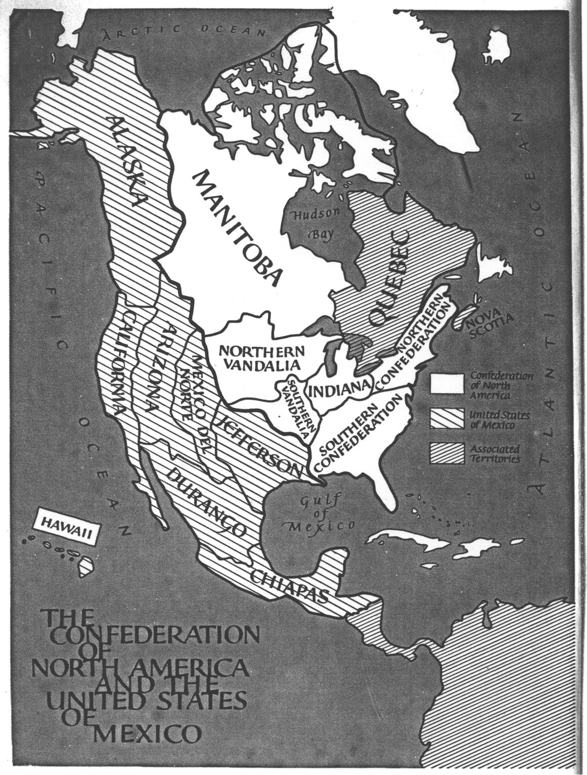
The frontispiece of For Want of a Nail . . . is a black-and-white map of the contemporary North American continent, showing the Confederation of North America and the United States of Mexico. The confederations of the C.N.A. and the states of the U.S.M. appear in outline. The map is the primary source of information on the borders of the confederations and states, and the border between the C.N.A. and the U.S.M.
The map contains several historically dubious boundaries: the area between Lake Michigan and the Mississippi River is part of Northern Vandalia rather than Indiana; the Northern Confederation includes all of mainland Nova Scotia, and all of Quebec south of the St. Lawrence River; Chiapas includes the Central American provinces of Guatemala and Honduras, as well as British Honduras. In addition, the border between Northern Vandalia and Southern Vandalia contradicts the text on p. 140, which states that the 40th parallel forms the boundary between the two.